
Long hours in work this week, but I was determined to get out and squeezed in a cheeky 10mile loop and a fair old lick coming home exactly half an hour later. With a bit of climbing and some headwind to contend with I was quite happy with that.
Tag: Exploring
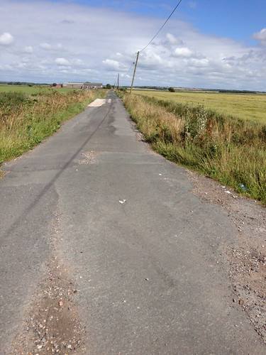
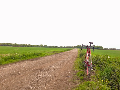
White Roads
A while back my dad came up to visit and was taken along with his camper van down a white road. It was one of those experiences where the road didn’t allow you to turn back and you are committed and it was a case of just keeping going. It sounded horrendous to drive. I didn’t know the road, so having only a short amount of time but wanting to get out I thought that I’d do some exploring. Sure enough, it was pretty much an unpaved surface with gravel sections, pot holes, subsidence and broken tarmac. A bit like my old commute to work in Manchester.
Still good ride. Managed to link up a nice little hour-long loop using some roads that are becoming familiar. The sun shone, it was warm, there wasn’t much traffic, but god damn it was windy riding back to Formby across the moss. Proper grind into the wind and having to resist the urge to drop down the gears. Home just in time for tea too.
To Bury
I really like point to point rides, but ending up miles from home at the end of the ride is generally not a good outcome. Consequently most of my P2P rides have been on supported trips like the Chamonix to Zermatt or have involved riding self supported with all my own kit like the Trans Cambrian Trail. Having the option of a lift home in the car is a new variation on me. It is however the option that let me ride up to Bury, crossing for the first time in my life Rivington on a bike. The rider names from the Commonwealth Games road race in 2002 are still painted on the road over to Belmont.
Ups and Downs
Having done the hills to the west of Durham last week I thought that I would do the run to the coast this week. This should really have been do the hills to the east of Durham. It is not flat, but there are some pretty interesting ups and downs to contend with. The road surfaces are some of the worst I’ve ridden. Rough tarmac at it’s worst – making the bike vibrate and bounce around. Amazingly it seems to have taken just over two hours to do less than 25 miles.
Now here’s the rub. I actually planned the route using Strava’s route planner and then was a bit put out by the difference in numbers recorded on the actual ride. I made a couple of detours, so I’ve just cloned and edited the planned route to represent the one I did. Strava’s route planner says:
35.3mi Distance and 2,681ft Elevation Gain
So why does the ride I actually did only come in at:
24.3mi Distance and 1,635ft Elevation Gain
To put a further twist on it, the Wahoo app I use to record the ride has logged it as:
23.2mi Distance and doesn’t show elevation gain.
Now why Strava corrects the data that is exported to it from the Wahoo app, I am not sure, but in th east it’s always seemed more plausible information.
I conclude that the Strava route planner software is just incorrect in its calculations. I had thought that the Wahoo / Strava issues was related to the recorded data via the speed sensor, but given that’s kaput at present I am at a loss to explain it – they both seem to use the same Google data.
All I know is my legs feel like they’ve done some climbing this evening and more than last week although Strava reckon’s it’s actual 20ft less climbing than that ride.
In other news, the turbo session yesterday evening seems to have buggered the speed sensor on my Wahoo SC bluetooth unit. The cadence still works and even a brand new battery purchased via a dash into the city this morning has refused to resurrect it. It’ll be off back to Wiggle for replacement.
Longest ride in years
Over 50 miles on a bike. I’ve not done that in a long time, but I did manage it today and actually felt good the whole ride. Even managed to set a new PB on one of the final stretches to home. Strava is good for letting you know when you think that you’ve had a good ride and match this agains past rides on the same roads. Stepping up the mileage seems to be working. More hill work during the week this week and perhaps a trip to the seaside in County Durham.

It was windy out there, but I just seemed to find a tempo that worked for me and pressed on (had achy knees on a couple of occasions). Stopped on Marine drive and took a photo across the Ribble Estuary – you can see Blackpool Tower…
Eshing Great
Was going to session the turbo yesterday, but it rained, rained, lashed it down and rained some more so I skipped that and went food shopping. Wise move as tonight was epic. Really in the rhythm on the climbs and seemingly endless descents at warp speed. Beautiful evening and warm enough for just shorts and jersey.
That was windy
Decided to head south and pick up the disused railway line that turns out to be the Trans Pennine Trail that you can join from the road between Sefton and Maghull. It would be fair to say that the surfaced section didn’t last long before it became smooth trail and then Singletrack.

Came back onto tarmac and headed across to Ormskirk, picking up the quiet A59 and heading up towards Preston. Ended up passing Martin Mere having explored a few route options that descended into private gravel roads.
Chuffing windy ride all in all – really suffered on the final push across the moss to Birksdale. Saw loads of chain gangs out during the ride.
A tale of Moss-adventure
Last night I mapped out a near 50 mile route in Strava for this morning. Then discovered that unless you have a Garmin computer, you can’t do much with it. So in the end, rode out this morning with the concept of a route in my head and managed about half of it and came in 18 miles short.
I had wanted to get to Chorley with the option in future of heading to Rivington, but was fundamentally screwed when I went the wrong way out of Ormskirk. My route took me back over some roads I’d ridden previously in reverse. I’d found it hard to follow routes here previously and it’s clear that Google Maps has a few errors around here:
Other tarmac roads just turned into gravelled roads which caused some amusement. 23mm slicks on dusty dirt roads gave some interesting handling and miraculously no punctures.
Still the headwind on the final coastal route home was horrendous so I was glad to get home with a few miles left in my legs.
Blast and Scout
Cashed in some banked hours at work and did a recce ride south, out towards Spennymoor and then into a loop back into Durham from the south west. Spennymoor looked okay, colleague at work said: “No, you don’t want to live there. I worked there for 20 years and couldn’t wait to escape.” Few other areas looked reasonable.
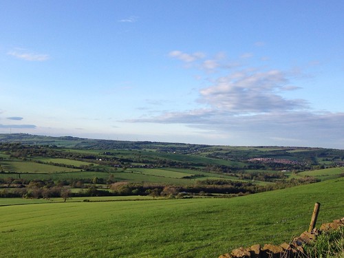
That evening, driving home I decided to explore some other areas. Weardale had some appeal, yet the 20 mile drive strikes me as a mission during the daily commute. Fab once you get there and some epic driving roads in that part of County Durham. Whether we live thee or not I can see some weekend and evening driving happening. Check out the views:
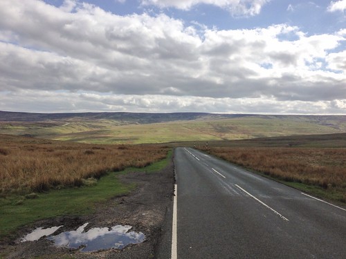
Out of Stanhope towards Teesdale
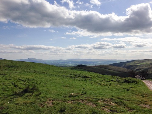
Between Middleton-in-Teesdale and Brough
Rainbow Ride
Taking a couple of days off at the tail end of the week was an opportunity to explore the area further. This time it was west again out of the city, but rather than an immediate uphill slog it started with a steady ride through the Deerness Valley out to Esh Winning. Winning was a word used to describe striking a coal seam, but the last open cast mines closed here in the 1990s and the landscape has been restored.
From the Herat of the village the road to Cornsay was taken but rather than riding into this colliery settlement, I turned south and began the ascent to Hedley Hill and across the moor. To the west a cracking rainbow lit the valley, it’s rare to see a full one, but the solid headwind and threat of rain encouraged me to press on.

At Tow Law it was time to head for home and wind a mega tailwind it was big ring time all the way. The road to Stanley Crook where I’d stayed in my first week gave some more great views and showed surface mining for coal still in action.

The rest of the ride was on roads I’d driven before, but never in daylight and it’s transformative to see the County in sunshine. Not a bad place to be…
